ClimWeb
Leading open-source Python-based software designed to empower climate and environmental institutions to deliver impactful services. Join a growing community.
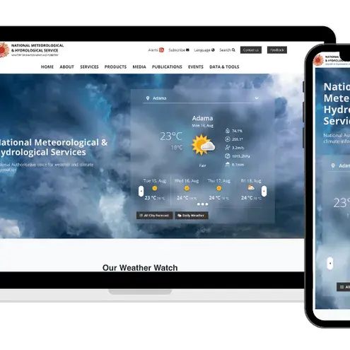
ClimWeb empowers National Meteorological and Hydrological Services (NMHSs) and environmental institutions to deliver critical climate information effectively through a comprehensive, open-source platform. Featuring intuitive content management, real-time satellite visualization, CAP alert composer, and integrated marketing tools, ClimWeb ensures weather and climate services reach decision-makers and communities when they need them most. Trusted by 40+ institutions across Africa, this innovative solution transforms how climate services are managed and communicated, enabling organizations to maximize their impact with modern, accessible technology.
Partners

40 countries trusting ClimWeb
Sudan, South Sudan, Ethiopia, Niger, Chad, Togo, Ghana, Gambia, Mali, Malawi, Burundi, Seychelles, Benin, Burkina Faso, Zimbabwe, Guinea Bissau, Congo, Democratic Republic of the Congo, Guinea, Comoros, Sierra Leone, Kenya, Liberia, Zambia, Djibouti, Burkina Faso Hydrology Department, Somalia, Mozambique Hydrology Department, Mauritania, Central African Republic.
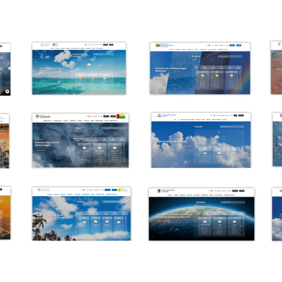
ClimWeb Instances
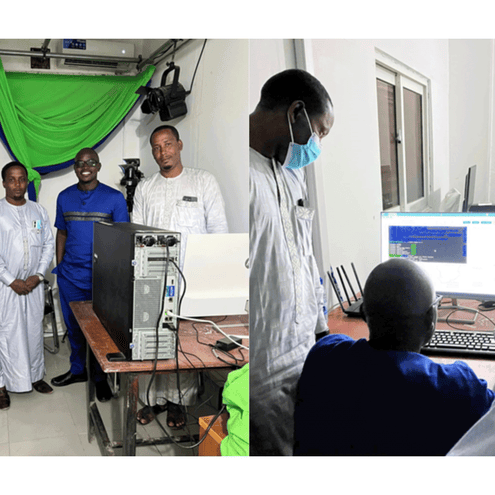
Climweb support to NMHS in Africa
Live instances of Climweb at NMHSs premises server or cloud servers in 31 countries with:
🔵 Live instances (31):
Sudan, South Sudan, Ethiopia, Niger, Chad, Togo, Ghana, Gambia, Mali, Malawi, Burundi, Seychelles, Benin, Burkina Faso, Zimbabwe, Guinea Bissau, Congo, Democratic Republic of the Congo, Guinea, Comoros, Sierra Leone, Kenya, Liberia, Zambia, Djibouti, Burkina Faso Hydrology Department, Somalia, Mozambique Hydrology Department, Mauritania, Central African Republic, Mozambique.
🔧 In development (9):
Uganda, Madagascar, Namibia, Sudan Hydrology Department, Lesotho, Egypt, Senegal, Cameroon, Botswana.
⚪️ To install (8):
Eswatini, Sao Tome Principe, Mauritius, Liberia Hydrology Department, Libya, Mauritius Hydrology Department, Regional Climate Center (RCC) for the Economic Community of Central African States (ECCAS) based in Douala, Regional Spencialized Meteorological Center Yaounde.
Total institutions (48), Countries (41).
Other regions: Haiti, Syria, Moldova, Afghanistan.
Your go to open source solution for climate service delivery
Transforming climate and environmental services with open-source innovation
Key Features
-
User-friendly Content Management System
A Website Template for Climate and Weather Services
-
Advanced Product Visualisation
Powerful Visualization for Clear, Actionable Climate Insights
-
Efficient CAP Alert Publishing
Seamless Creation and Communication of Alerts
-
Advanced Digital Marketing Tools
Integrated Solutions for Outreach and Public Engagement
Advanced Product Visualisation
Transform your climate and environmental services with open-source innovation
-
Explorer of cities climatology
ClimWeb enables the visualization of cities' climatology, providing detailed insights into climate patterns for urban areas.
-
Interactive Aviation Visualisation Tool
ClimWeb’s aviation weather tool visualizes real-time METAR and TAF messages, providing critical weather data for pilots, air traffic controllers, and flight planners to enhance situational awareness and decision-making.
Accelerating climate services with open source innovation
Transforming climate and environmental services with open-source innovation